REMINDER: Next Waterford Historical meeting is on Wed. Feb. 22 at 6 p.m. at the Davies Memorial Library.


 |
| Llechwedd Slate Mine, Blaenau Ffestiniog, Wales |
Slate
Metamorphic rock found in southwestern Vermont. It is formed by the compaction and heating of clay, silt or mud. Vermont slate varies in color from red, green, black and purple. Because it splits into thin slabs, slate is used for roofing shingles, sidewalks and floor tiles.
Slate: Three ranges of roofing slate:
From Office of the Secretary of State, Vermont Legislative Directory and State Manual, Biennial Session, 1993–1994, p. 23.
- Eastern, clay slate near Connecticut river, from Massachusetts line to Essex county; found in Guilford, Windham county; Thetford, Orange county; Waterford, Caledonia county; and other localities and small quarries.
- Middle range of clay slate extends from Memphremagog lake to Barnard slate quarries in Northfield, Montpelier, and elsewhere of uniform shade and black.
- Western Vermont slate quarried largely in Castleton; also in Fairhaven, Poultney, Wells, and Pawlet, Rutland county; generally of a dark purple color, with occasional blotches of green; very compact and fissile. Large quarries near West Castleton, Hydeville, Scotch hill, and Fairhaven.

 |
| George Porter Ela of Lisbon NH, who would marry Frances Harriet Rowell of Waterford VT. |

James Adams was one of the earliest Waterford settlers (by which I mean, people of European descent who came to establish permanent homes in the town). Dr. C. E. Harris's town history, A Vermont Village, gives Adams credit for being on hand as early as 1783.
The replaced stone for James's wife Submit is shown here, at the Adams-Babcock Cemetery on East Village Road (in a gentler season). According to Vermont author Alan Boye, as reported in his Vermont Public Radio commentary captured in the book Vermont Air, Submit Adams was of Abenaki heritage.
What evidence is there for Mrs. Adams' background and life? Details would be much appreciated!
UPDATE, Dec. 4, 2020: Submit Adams was NOT of Abenaki heritage. I will provide a detailed history of her background in a separate post.

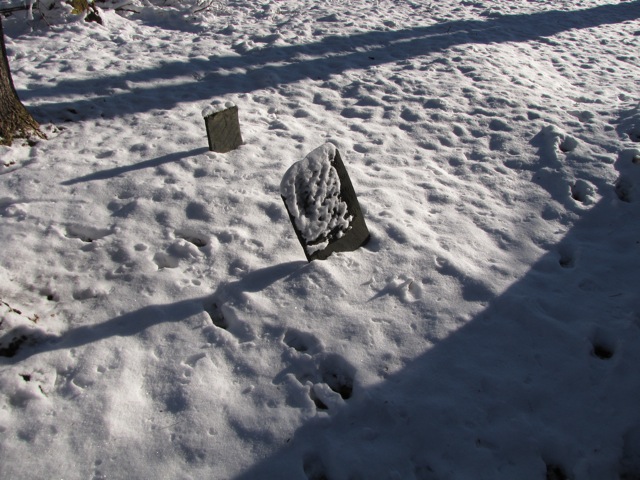


This cemetery is in the woods, north of a pasture, in what was once an orchard. The ground is covered with ground-myrtle with very little grass. It is on the Lot drawn by James Adams as part of his proprietor's Right which probably became son, Charles Adams' farm.
It has been called variously, Adams Cem, Babcock Cem, The Settlers' Cem; and when its overgrown condition was "put right" in the Bi-centennial year, Helen Knight dubbed it "the Myrtle Cemetery" because of the quantities of ground myrtle in it, a name which has stuck with us locals; although the "official" sign now by the road reads, "Adams-Babcock Cemetery".
It had pretty much been forgotten until the Bi-centennial year when a group of men from the Waterford and East St Johnsbury Churches cleared it out, cutting brush and putting up a snow-fence provided by the town. It has a stone wall on the southeast & southwest sides.
The entrance is from a path with a sign reading, "Adams-Babcock Cemetery" on the right side of East Village Road going uphill, 0.7 mi from the bridge off US Rte 2 in East St Johnsbury Village (bear right after the bridge), 100 yards before the right-turn onto Walsh Rd. Path is down from the side of the road, across the brook on a plank bridge, and up a short, steep bank to an opening in the fence.
If your knees cannot handle steep, slippery paths; there was an entrance from the pasture on the east corner (as a long ago discontinued road once passed this way). It is a longer walk; but, it is level walking. To reach this entrance, stop at Mrs. Fissette's (just south of the turn onto Walsh Rd) and get directions and permission to cross her land.


